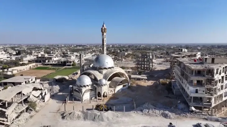
Location:
Harasta, Rural Damascus.
Nature of Work:
A research and application project that integrates artificial intelligence (AI) technologies (such as satellite image analysis and automated damage classification) with community participation to assess residential building damage, prioritize recovery efforts, and create interactive maps and a unified database to support municipal decision-making. It includes training local volunteers in data collection and a local workshop to present the results.
Significance:
: Provides a reliable scientific framework for decision-making in the post-conflict recovery phase, enhances the capacity of the municipality and the community in using data for urban planning, offers a replicable model for other Syrian cities, and helps bridge the gap between field data and planning decisions while promoting transparency and accountability.
Stakeholders:
Kafaat (Lead), Harasta Municipality (Local Partner), Local Community/Volunteers, Aubrey Parker Fund (ABF) and FIG Foundation (Donors), AI and GIS Experts
Project Team:
Ghada Al-Rifai,
Hussein Bashir,
Adnan Kayali,
Dr. Salah Al-Haj Ismail.
Timeline:
8 months; Start: August 22, 2025; End: April 30, 2026